Better information leads to better decisions. BargeOps now connects directly with US Army Corps of Engineers (USACE) data sources to keep gauge and dam opening information up to date. Having current data for the Lower Gauge and Openings for locks helps with planning and executing a trip given the current river conditions. We’ve added the ability to record lock or gauge location, facility characteristics, flood stage, pool stage, low water, normal current, high water, and catastrophic level. In BargeOps, this information is available in BargeOps Onboard.
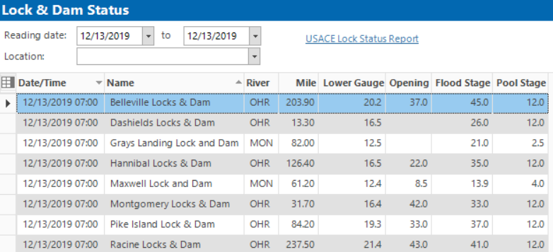
This same information is available in the BargeOps Analytics module analyze trips later. For example, as you analyze company performance over a period of time, river conditions play a significant factor affecting how many barges were moved by your boats in that period.